
Trace a Friendswood Street Directory
A street-based search can establish a chain of public property and recorded-interest information. It cannot create a complete list of everyone connected to a road. GCAD starts the Galveston-side chain with a parcel, owner of record, situs, and legal description. The next step is the county deed index, which records parties and instruments. City permit data adds a dated project record. A lawful voter route can answer a much narrower registration question. Regional address directories may add a historical listed-household clue when the relevant volume exists.
Work parcel by parcel. One street may contain many accounts, subdivisions, and legal descriptions. A name alone can collide, while a property ID and lot or block give the trail a stable reference. If the address appears near Clear Creek, establish the county before choosing an appraisal district or deed custodian. Preserve the date of every result because a recorded transfer or permit may be older than the present address question.
- Search the address in GCAD and copy the property ID, geographic ID, situs, and legal description.
- Check the parcel’s county, especially near the Clear Creek boundary.
- Search AVA by owner or legal description and compare the recorded parties, date, and instrument number.
- Check CityWorks or the city archive for site-address activity, not a statement about occupants.
- Use the Texas voter route only through its official or lawful request process, then use regional directories for a dated historical clue.
Note: The strongest street result is a documented parcel chain, not a list inferred from one address field.
Search Friendswood Streets in GCAD
The free GCAD property search is built for the Galveston County part of Friendswood. Search by street number and street name, or begin with an owner, property ID, geographic ID, subdivision, neighborhood, or advanced filter. GCAD’s own hints advise simplifying a street search. Leave out the prefix, suffix, and unit number if a full address does not return the expected account. Owner searches can also work better with only a first or last name.
| GCAD field | Street-search use | Important limit |
|---|---|---|
| Street Number | Narrows an address result | Does not replace the parcel identifier |
| Street Name | Finds matching street parcels | Use no prefix, suffix, or unit when simplifying |
| Property ID | Tracks one appraisal account | It is not a deed instrument number |
| Geographic ID | Supports parcel and map comparison | Keep it with the county and access date |
| Subdivision | Helps when a deed uses lot and block wording | Check the legal description before assuming a match |
GCAD calls this public research information and asks users to verify legal descriptions and acreage before using them in legal documents. A result can include values, exemption flags, characteristics, and remarks in addition to the owner and situs fields. Those details give address context, but an appraisal account is neither title proof nor a full residents list.
Friendswood Situs and Mailing Fields
GCAD separates the physical parcel location from the owner’s correspondence information. The situs address identifies the property. A mailing address is the place where tax correspondence goes. GCAD’s owner and property correction form has separate choices for correcting the owner mailing address and correcting the property location or address. That form is a practical warning against turning a correspondence field into a claim that its recipient lives at the parcel.
The legal description is the third essential field. It can contain a subdivision, lot, block, abstract, or other land reference. It often survives a spelling difference in a street string and gives the AVA deed search a firmer key. A sample GCAD card uses both account-style identifiers and a Longwood Park legal description, showing why a street number alone is not enough for property research.
GCAD’s published sample card reports a $1,008,090 market value and a $642,670 homestead-cap loss for that one example parcel. Those figures illustrate the appraisal fields available on a card. They are not a street average, a current value for another parcel, or evidence about an occupant.
- Parcel
- A mapped or appraisal unit of land with an account or geographic identifier.
- Situs address
- The physical location of the property.
- Mailing address
- The correspondence location displayed for an owner, which can differ from the situs.
- Plat
- A recorded subdivision map that can show lots, blocks, roads, and easements.
- Criss-cross directory
- A historical address-to-listed-person directory, used only for the year and coverage it actually has.
Friendswood Streets Across Clear Creek
Clear Creek separates the northern Galveston County and southern Harris County portions of Friendswood. That geography controls which custodian has the property and recorded-land trail. It can also make a city label look more uniform than the records really are. When GCAD’s map context or legal description points to a Harris-side parcel, switch to the Harris County Clerk’s real-property route and use the Harris appraisal channel after confirming the parcel jurisdiction.
Harris County’s online real-property search has its own grantor, grantee, legal-description, date, lot, block, and instrument fields. Its online images begin November 1, 1960, while the historical warehouse has older books. The Harris portal also says it is not the official repository and warns that some information is redacted. A street directory method should therefore note both county and source status before a record is compared to the next parcel.
City and postal geography add another layer. The city’s official GIS PDF can show streets, subdivisions, creeks, school areas, and county lines, but it is approximate and not a survey. It gives context for the boundary; it is not a parcel-level owner tool.
Friendswood Street Deed Trails
The Galveston County AVA official-records search turns a parcel’s legal description into a recorded-instrument trail. AVA offers party name, document number, date, book and page, address, ZIP, subdivision, lot, block, parcel, municipality, and tract fields. A result can identify the document number, type, recorded date, parties, legal summary, and sometimes associated documents or an image control. Image availability can vary.
Start with the current owner or grantee and narrow by legal description, date, or document type. Then take the seller or grantor from that instrument and search them as a prior grantee. Match the lot, block, subdivision, or other legal wording at each step. Follow the legal description rather than assuming every same-name or same-street result concerns the same property. Search the current party as grantor as well when checking later transfers or releases.
The county does not state an official online cutoff for AVA. When the digital trail ends, the fallback chain is the clerk, older county deed books, and Texas State Library and Archives Commission holdings. TSLAC identifies Galveston deed records beginning in 1838. That is a historical catalog start, not a promise that every year or image is online.
Friendswood Permit Records by Address
City permits provide property-activity context keyed to a site address. Friendswood’s permit instructions say construction, moves, additions, and structural alterations need permits, with examples such as fences, generators, irrigation, storage buildings, and pools. The city’s September 2025 issued-permit archive sample includes issue date, permit number, permit type, site address, contractor, county, fees, valuation, and description. A permit can date activity at a parcel, but it does not establish ownership or who occupied it.
Friendswood’s online permits and inspections instructions describe the current route.
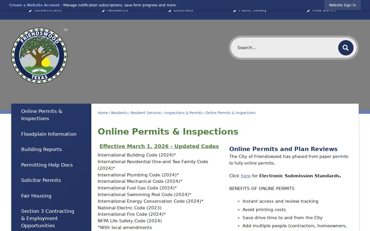
The permit channel gives a site address and project context that can be compared with the parcel, deed date, and legal description.
CityWorks is fully online for current permitting. A user creates or signs into an account, confirms email, submits an application, tracks it, schedules inspections, and pays through the service. The city identifies March 1, 2026 effective code editions, but those code dates do not create an older permit archive. Older regular coverage was not published in the captured sources.
The Friendswood CityWorks portal is shown below.
Use the current portal for an account-based permit workflow and the issued-permit archive for the dated fields it actually publishes.
Note: Code complaints can be submitted by address, but no public city code-case index was located.
Friendswood Street Record Sources
Each address-keyed source uses a different key and answers a different question. The practical sequence is address to parcel ID, parcel ID to legal description, legal description to deed index, then permits, directory material, or a lawful voter route as needed. A table is more useful than a streetwide name list because it keeps the source’s meaning visible.
| Friendswood source | Key | Street result | Access and limit |
|---|---|---|---|
| GCAD appraisal account | Street or parcel identifier | Owner of record, situs, legal description, values | Free Galveston-side search; no complete occupant list |
| Recorded instrument | Legal description and parties | Recorded interests, dates, grantor, grantee | AVA or Harris-side clerk; online range varies |
| City permit | Site address | Project and contractor context | Current CityWorks and 2025 sample archive |
| Texas voter information | Official lookup or lawful file | Limited registration information | Protected fields and addresses remain restricted |
| Regional directory | Address and edition year | Listed household clue | Friendswood run must be confirmed |
| USPS lookup | Deliverable address | Standard ZIP and city label | Does not identify a person or organization |
For the full current street-by-street parcel chain, retain the parcel ID, legal description, county, and access date together. Each field makes it easier to distinguish two nearby properties or two results with similar names.
Friendswood Voter Address Rules
Texas voter records are not an open street browser. The official Secretary of State voter route says a Texas driver license or state ID is needed to begin the current status lookup. The research capture did not expose every live result label, so no unobserved field should be promised. A registration match can support a limited, lawful status question. It does not identify every person linked to a parcel.
Election Code Chapter 18 allows a voter-file request through a state form and affidavit. The source states a $75 deposit, a delivery deadline no later than the fifteenth day, fixed-width ZIP text, protected-address exclusions, and no Social Security numbers. The affidavit limits commercial advertising and promotional use. Preserve any protected-address suppression and do not attempt to reconstruct it from other address fields.
Friendswood Street Directory History
Historical address material is regional and must be described that way. The Galveston & Texas History Center says its address cross-references begin in 1908 and lists shelf examples from 1899 to 1900 and 1919 forward. Those materials are Galveston-centered. They can be useful for an address trail when a Friendswood household appears, but the captured sources do not publish an exact Friendswood directory run. A missing result in a regional volume is not evidence that an address was empty.
The Galveston & Texas History Center genealogy resources are the appropriate regional fallback. Inspect the exact volume, its front-matter abbreviation key, date, page, and city or county label before transcribing an entry. The center’s city-directory holdings, along with Friendswood Library reference assistance, can help locate nearby Galveston, Houston, Clear Lake, or Alvin materials without presenting any of them as a confirmed Friendswood run.
When the research goal turns from a full street to one dated household, the Friendswood city directory route explains how to read the historical collection evidence.
Note: A regional directory must be checked for its exact place, year, publisher, and address coverage before use.
Friendswood Street Map Context
GCAD advertises an Interactive Map, but the exact live parcel-viewer URL was not exposed in the source inspection. Do not assume its click, measurement, or buffer tools. The safe method is to search a street in GCAD, record the property or geographic ID, and use the verified legal description for the deed search. The official city GIS PDF provides a static context layer for streets, subdivisions, schools, creeks, city limits, and county lines. It warns that it is approximate and not a survey.
Friendswood zoning adds a different kind of address context. The city zoning page provides a zoning map, interactive map route, and zoning-verification form. The captured page says the adopted map runs through August 2024 and describes current zoning verification within 30 days, with stated 48-hour processing. Zoning describes land-use context, not a resident record.
The verified zoning route is shown on the Friendswood zoning page.
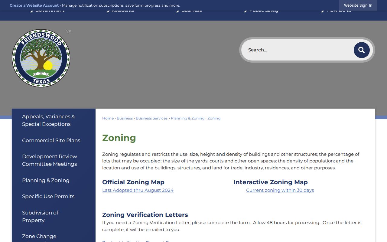
Use the map to understand the street’s municipal and land-use setting, then return to the appraisal and clerk records for parcel or recorded-interest questions.
Friendswood Street Directory Limits
Street records can show a property account, situs, owner of record, a recorded interest, a permit, or a dated listed-household clue. They do not create a public file of unlisted occupants, household members, utility customers, mail recipients, or driver-license addresses. A homestead flag is an exemption claim, not a current-residence conclusion. A permit names activity at an address, not everyone tied to the property.
Use the correct public custodian, keep sensitive material out of notes, and distinguish owner mailing fields from situs fields. A parcel polygon shows land adjacency, not a personal relationship.